Navionics+ NASA005L Chile, Argentina & Easter Island
Brand New
Product # 010-C1365-30
The Navionics+ NASA005L is a microSD card that provides a detail-rich mapping of rivers, lakes, coastal waters, and more. With SonarChart™ 1? ( 0.5 meters) HD bathymetry maps, you advanced features like Dock-to-Dock Route Guidance Technology (depending on the Chartplotter model) that suggests you the path to follow through marina entrances, channels, inlets, and more, Plotter Sync enables wireless access to daily updates, and Live Mapping with the freshest chart data every time. Additionally, with multiple shading options, it is easy to locate the best fishing spots through shallow water navigation.
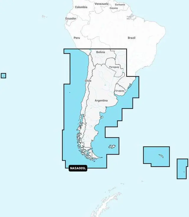
The NASA005L microSD card covers the coastal area of Chile, Argentina & Easter Island. Coverage includes Easter Island, Cape Horn, the Falkland Islands/Islas Malvinas, the South Georgia Islands, the South Sandwich Islands, and the Rio de la Plata.
Navionics+ NASA005L Features:
Chile, Argentina & Easter Island Marine Charts
Coastal Coverage
Dock-to-Dock Route Guidance Technology
SonarChart™ Live
Plotter Sync
- Plan on Mobile, go on Plotter
Integrated Garmin & Navionics® Data
Multiple Shading Options