Your Browsing History

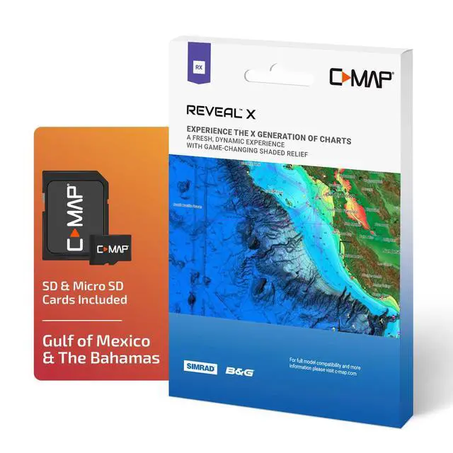


Reveal X - Gulf of Mexico & The Bahamas, Map Card for Marine GPS chartplotters
Limited time offer, ends 08/03 By Eristy shop
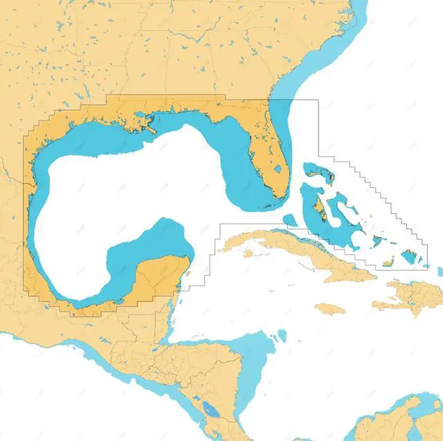
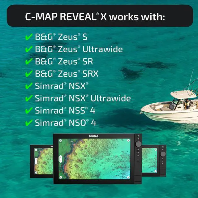
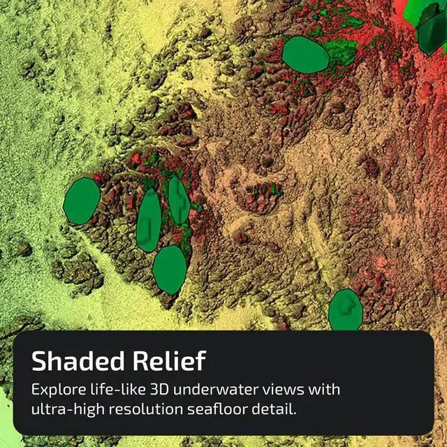
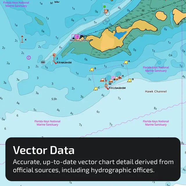
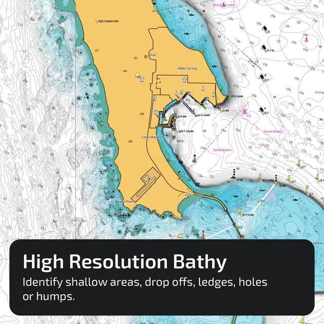
- FULL-FEATURED VECTOR CHARTS: Offers straightforward navigation with precise, current vector chart details sourced from official Hydrographic Office data. HI-RES BATHYMETRY LAYER: Aids in locating shallow zones, drop-offs, ledges, holes, or humps. Contains high-resolution bathymetry data with integrated Genesis social map data. SUBSCRIPTION-FREE AUTOROUTING: Automatically calculates the shortest, safest path using detailed chart data and personalized vessel information. SHADED RELIEF: Animates the world with 3D rendered land and underwater elevation, incorporating areas of Ultra-High-Res Bathymetric imagery, perfect for anglers and divers. CUSTOM DEPTH SHADING: Enables setting a distinct safety depth, preserving a paper-like view, or generating custom shading. COMPATIBILITY: This chart is designed for the latest Simrad and B&G chartplotters running NEON. INSTALLATION: The product arrives programmed on a Micro-SD card placed in an SD adapter. Most chart plotters include a Micro SD card reader. To utilize this chart, take out the Micro-SD card from the SD adapter
+
+
Overview
Specs
Reviews
Any questions? Our AI beta will help you find out quickly.
Try me now
FULL-FEATURED VECTOR CHARTS: Offers straightforward navigation with precise, current vector chart details sourced from official Hydrographic Office data. HI-RES BATHYMETRY LAYER: Aids in locating shallow zones, drop-offs, ledges, holes, or humps. Contains high-resolution bathymetry data with integrated Genesis social map data. SUBSCRIPTION-FREE AUTOROUTING: Automatically calculates the shortest, safest path using detailed chart data and personalized vessel information. SHADED RELIEF: Animates the world with 3D rendered land and underwater elevation, incorporating areas of Ultra-High-Res Bathymetric imagery, perfect for anglers and divers. CUSTOM DEPTH SHADING: Enables setting a distinct safety depth, preserving a paper-like view, or generating custom shading. COMPATIBILITY: This chart is designed for the latest Simrad and B&G chartplotters running NEON. INSTALLATION: The product arrives programmed on a Micro-SD card placed in an SD adapter. Most chart plotters include a Micro SD card reader. To utilize this chart, take out the Micro-SD card from the SD adapter
Warranty & Returns
Warranty, Returns, And Additional Information
Warranty
- Please contact the Seller directly for warranty information. Warranty information may also be found on the Manufacturer's website.
- CONTACT
Return Policies
- Return for refund within: 30 days
- Return for replacement within: 30 days
- This item is covered by Eristy shop Return Policy
Manufacturer Contact Info
- For a directory of all our manufacturers, please click below.
- Manufacturers Directory
LOADING...