Your Browsing History

Meet Your Seller


S190 Handheld GPS Navigator, Rugged Handheld GPS for Hiking with 3-Axis Compass, 3.2" Color Display, Handheld GPS with Preloaded USA Topo Maps, 64GB Memory and Extra Battery Life
Limited time offer, ends 07/28 By Jeronrtion
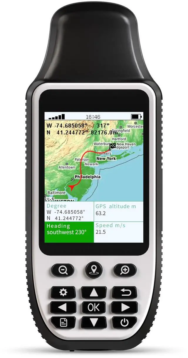
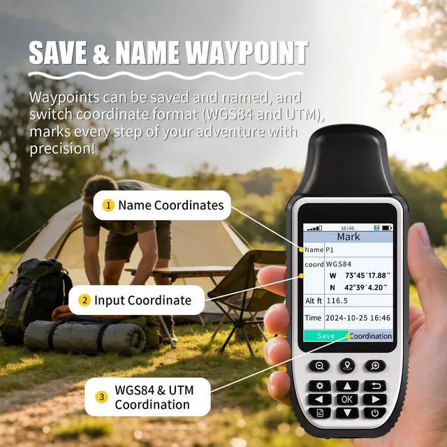
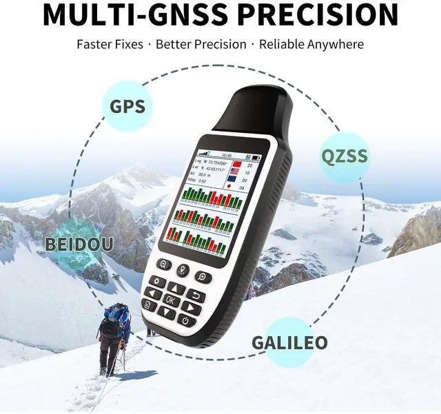
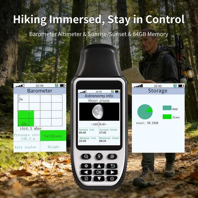
- This handheld GPS device records your precise route and guides you back along the same path. The integrated 3-axis compass provides accurate heading even when you are stationary, helping you maintain your course. It comes preloaded with USA Topo maps and a worldwide basemap for hiking and camping. The unit features 64 GB of internal memory for downloading additional maps. It connects to GPS, Galileo, QZSS, and BeiDou satellite systems for enhanced positioning accuracy, ensuring reliable location data anywhere. It offers up to 36 hours of operation, which is advantageous for extended hikes or overnight excursions, minimizing power concerns. The 3.2-inch sun-readable screen is easy to view even in bright daylight, simplifying navigation. Additional features include a barometric altimeter for tracking elevation. It supplies sunrise and sunset times for better trip planning and includes an area measurement function for land layouts and surveying. It has an IP66 rating for protection against splashes, rain, and similar conditions
+
+
Overview
Specs
Reviews
Any questions? Our AI beta will help you find out quickly.
Try me now
This handheld GPS device records your precise route and guides you back along the same path. The integrated 3-axis compass provides accurate heading even when you are stationary, helping you maintain your course. It comes preloaded with USA Topo maps and a worldwide basemap for hiking and camping. The unit features 64 GB of internal memory for downloading additional maps. It connects to GPS, Galileo, QZSS, and BeiDou satellite systems for enhanced positioning accuracy, ensuring reliable location data anywhere. It offers up to 36 hours of operation, which is advantageous for extended hikes or overnight excursions, minimizing power concerns. The 3.2-inch sun-readable screen is easy to view even in bright daylight, simplifying navigation. Additional features include a barometric altimeter for tracking elevation. It supplies sunrise and sunset times for better trip planning and includes an area measurement function for land layouts and surveying. It has an IP66 rating for protection against splashes, rain, and similar conditions
Warranty & Returns
Warranty, Returns, And Additional Information
Warranty
- Please contact the Seller directly for warranty information. Warranty information may also be found on the Manufacturer's website.
- CONTACT
Return Policies
- Return for refund within: 30 days
- Return for replacement within: 30 days
- This item is covered by Jeronrtion Return Policy
Manufacturer Contact Info
- For a directory of all our manufacturers, please click below.
- Manufacturers Directory
LOADING...