Your Browsing History


| Brand | GARMIN |
|---|---|
| Type | Map & Software |
| Compatibility | Astro Colorado 300 Colorado 400c Colorado 400i Colorado 400t Dakota 10 Dakota 20 Edge 605 Edge 705 eTrex Legend C eTrex Legend Cx eTrex Legend H eTrex Legend HCx eTrex Summit HC eTrex Venture Cx eTrex Venture HC eTrex Vista C eTrex Vista Cx eTrex Vista H eTrex Vista HCx GPS V GPSMAP 196 GPSMAP 276C GPSMAP 278 GPSMAP 296 GPSMAP 376C GPSMAP 378 GPSMAP 396 GPSMAP 478 GPSMAP 495 GPSMAP 496 GPSMAP 60C GPSMAP 60CS GPSMAP 60CSx GPSMAP 60Cx GPSMAP 62 GPSMAP 620 GPSMAP 62s GPSMAP 62st GPSMAP 640 GPSMAP 76C GPSMAP 76CS GPSMAP 76CSx GPSMAP 76Cx GPSMAP 76S GPSMAP 78 GPSMAP 78s GPSMAP 78sc GPSMAP 96C nüLink! 1695 nüvi 1200 nüvi 1250 nüvi 1260T nüvi 1300 nüvi 1300LM nüvi 1350 nüvi 1350LMT nüvi 1350T nüvi 1370T nüvi 1390LMT nüvi 1390T nüvi 1450 nüvi 1450LM nüvi 1450LMT nüvi 1450T nüvi 1490LMT nüvi 1490T nüvi 1690 nüvi 200 nüvi 200W nüvi 205 nüvi 205W nüvi 2200 nüvi 2250 nüvi 2250LT nüvi 250 nüvi 250W nüvi 255W nüvi 260 nüvi 260W nüvi 265T nüvi 265WT nüvi 270 nüvi 275T nüvi 285WT nüvi 295W nüvi 350 nüvi 360 nüvi 370 nüvi 3750 nüvi 3760LMT nüvi 3760T nüvi 3790LMT nüvi 3790T nüvi 465LMT nüvi 465T nüvi 500 nüvi 5000 nüvi 550 nüvi 600 nüvi 610 nüvi 650 nüvi 660 nüvi 670 nüvi 680 nüvi 750 nüvi 755T nüvi 760 nüvi 765T nüvi 770 nüvi 775T nüvi 780 nüvi 785T nüvi 850 nüvi 855 nüvi 880 nüvi 885T |
|---|---|
| Specifications | Oregon 200 Oregon 300 Oregon 400c Oregon 400i Oregon 400t Oregon 450 Oregon 450t Oregon 550 Oregon 550t Quest Quest 2 Rino 520 Rino 520HCx Rino 530 Rino 530HCx StreetPilot 2610 StreetPilot 2620 StreetPilot 2650 StreetPilot 2660 StreetPilot 2720 StreetPilot 7200 StreetPilot 7500 StreetPilot c330 StreetPilot c340 StreetPilot c510 StreetPilot c530 StreetPilot c550 StreetPilot c580 zumo 220 zumo 450 zumo 550 zumo 660 zumo 665 |
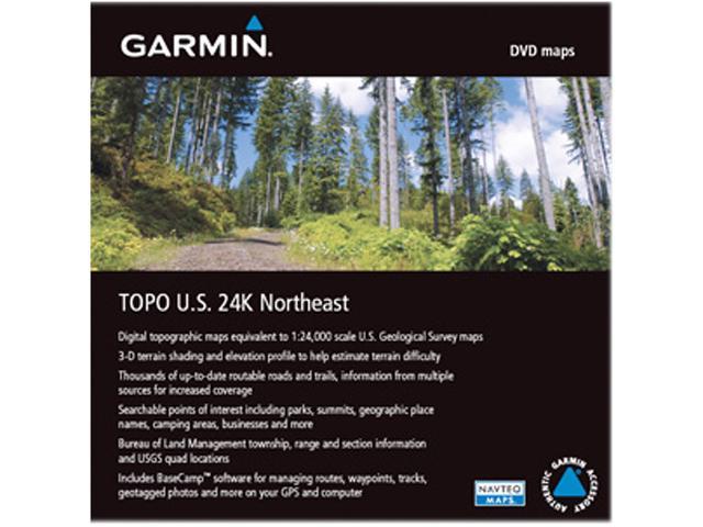
| Features | Includes topographic coverage of Wisconsin, Michigan, Illinois, Indiana, Ohio, Pennsylvania, New Jersey, New York, Connecticut, Rhode Island, Massachusetts, Vermont, New Hampshire and Maine. Provides detailed digital topographic maps, comparable to 1:24,000 scale USGS maps. Contains detailed hydrographic features, including coastlines, lake and river shorelines, wetlands and perennial and seasonal streams. Allows you to search by points of interest, including cities, summits, lakes, campsites and more. Provides elevation profile on compatible Garmin devices so you can estimate terrain difficulty. Contains many routable trails, rural roads, city neighborhood roads, major highways and interstates. Displays national, state and local parks, forests, conservation areas and wilderness areas. Includes points of interests such as parks, campgrounds, scenic lookouts and picnic sites. Displays Bureau of Land Management township, range and section information and USGS quad locations. Includes BaseCamp software for managing data on GPS and computer, playing back routes and tracks, geotagging photos and more. |
|---|
| Date First Available | April 01, 2011 |
|---|
