

Your Browsing History


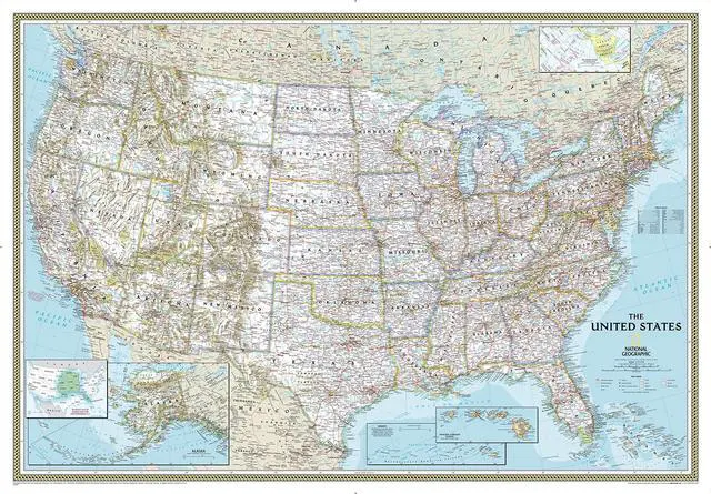

National Geographic United States Wall Map Classic Enlarged - Laminated (69.25 x 48 inches) (National Geographic Reference Map)
Limited time offer, ends 08/27 By CoreComp Shop
- United States Maps of America Establishing the highest standard for cartographic excellence. Since releasing its first map of the United States of America in 1923, it has been a global leader in the art and science of mapmaking. The distinctive cartographic style is characterized by attractive color palettes, proprietary typefaces, hand-drawn shaded relief, and thoroughly researched content. The focus on detail and precision is what truly distinguishes it from other mapmakers. Every map is meticulously compiled based on the latest data sources and independent verification of road networks, place-names, and National Park boundaries. When this level of research is combined with excellent design, the result is the finest line of U.S. maps currently offered. Wall Map Formats: Paper: High-quality matte poster stock, printed in the USA. Laminated: Plastic gloss lamination enhances durability. Poster size: 24" x 36", designed to fit precut poster frames. Standard size: Approximately 30" x 46". Enlarged size: Approximately 48" x 73". Mural size: Approximately 77" x 110", arrives as three panels that mount using wallpaper glue. Four distinctive styles: Classic: The Classic style is the traditional design that has been featured in many of the maps produced as supplements in the magazine over the years. Highlights include blue oceans with bathymetric contour steps, brightly-colored tint bands along country and state borders, and hand-drawn shaded relief. This style contains the highes
+
+
Overview
Specs
Reviews

Any questions? Our AI mode will help you find out quickly.
Try me now
United States Maps of America Establishing the highest standard for cartographic excellence. Since releasing its first map of the United States of America in 1923, it has been a global leader in the art and science of mapmaking. The distinctive cartographic style is characterized by attractive color palettes, proprietary typefaces, hand-drawn shaded relief, and thoroughly researched content. The focus on detail and precision is what truly distinguishes it from other mapmakers. Every map is meticulously compiled based on the latest data sources and independent verification of road networks, place-names, and National Park boundaries. When this level of research is combined with excellent design, the result is the finest line of U.S. maps currently offered. Wall Map Formats: Paper: High-quality matte poster stock, printed in the USA. Laminated: Plastic gloss lamination enhances durability. Poster size: 24" x 36", designed to fit precut poster frames. Standard size: Approximately 30" x 46". Enlarged size: Approximately 48" x 73". Mural size: Approximately 77" x 110", arrives as three panels that mount using wallpaper glue. Four distinctive styles: Classic: The Classic style is the traditional design that has been featured in many of the maps produced as supplements in the magazine over the years. Highlights include blue oceans with bathymetric contour steps, brightly-colored tint bands along country and state borders, and hand-drawn shaded relief. This style contains the highest level of detail. This map is presented in the Lambert Conformal Conic projection, which minimizes distortion in midlatitudes with east-west orientation. Executive: The Executive style is an ideal complement for home and office décor as it pairs nicely with wood and leather furnishings. Featuring an antique, earth-tone color palette combined with up-to-date cartography, this has become the bestselling U.S. map design. The subdued beige of the oceans combines nicely with the soft-colored tint bands along country and state borders. This style contains the highest level of detail. This map is presented in the Lambert Conformal Conic projection, which minimizes distortion in midlatitudes with east-west orientation. Decorator: The Decorator style is the brightest of the U.S. map designs and is perfect for kids bedrooms, classrooms, and those who want a pop of color on the wall. Featuring solid colors filling each state, pale blue oceans, and a black border around the whole image, this U.S. map is attractive and easy-to-read. This style contains the second highest level of detail. This map is presented in the Lambert Conformal Conic projection, which minimizes distortion in midlatitudes with east-west orientation. Explorer: The Explorer style is the most economical option in the U.S. map product family. It is quite similar to the Decorator style, featuring the brightest color palette of the U.S. map designs. It is perfect for kids bedrooms and classrooms. Featuring solid colors filling each state, pale blue oceans, and a decorative grid-style border around the whole image, this U.S. map is attractive and easy-to-read. This style contains the second highest level of detail. This map is presented in the Lambert Conformal Conic projection, which minimizes distortion in midlatitudes with east-west orientation
Warranty & Returns
Warranty, Returns, And Additional Information
Warranty
- Please contact the Seller directly for warranty information. Warranty information may also be found on the Manufacturer's website.
- CONTACT
Return Policies
- Return for refund within: 30 days
- Return for replacement within: 30 days
- This item is covered by CoreComp Shop Return Policy
Manufacturer Contact Info
- For a directory of all our manufacturers, please click below.
- Manufacturers Directory
LOADING...