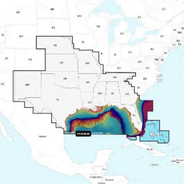
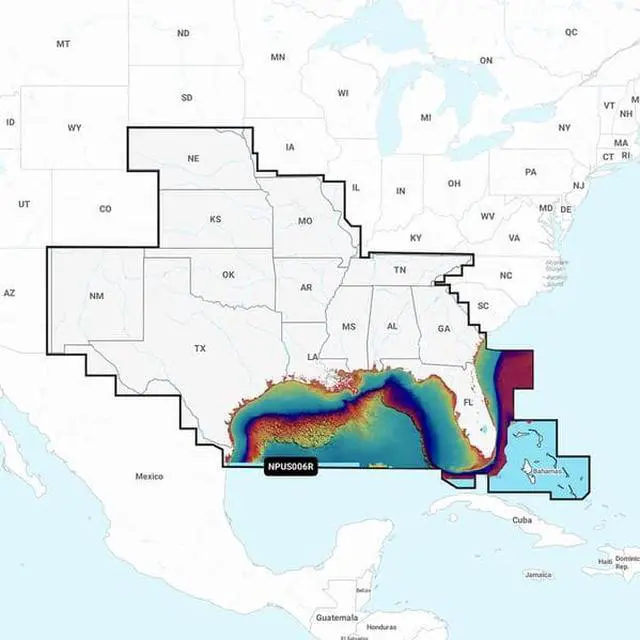
NPUS006R - U.S. SouthGet the world’s No. 1 choice in marine mapping - with the best, most up-to-date Navionics Platinum+ cartography on your compatible chartplotter.KEY_TAB For offshore or inland waters, this all-in-one solution offers detail-rich integrated mapping of coastal waters, lakes, rivers and more. KEY_TAB Get SonarChart™ 1’ (0.5 meter) HD bathymetry maps, advanced features such as dock-to-dock route guidance technology, live mapping and Plotter Sync to provide wireless access to daily updates.The Navionics Chart Installer software also ensures the freshest chart data every time out. KEY_TAB Navionics dock-to-dock route guidance solutions give you a suggested path to follow through channels, inlets, marina entrances and more. KEY_TAB Multiple shading options aid in shallow water navigation and make it easy to highlight a target depth range for the best fishing spots.Navionics Platinum+™ charts include all the content of Navionics®+ cartography, with integrated offshore and inland mapping, 42,000+ lakes and additional viewing options for relief shading, satellite imagery with SonarChart shading overlay, 3D perspective view, aerial photos, and more.Chart Code - NPUS006RCoverage Area:Coverage of the lakes, rivers and coasts of Alabama, Arkansas, Florida, Georgia, Kansas, Louisiana, Mississippi, Missouri, Nebraska, New Mexico, Oklahoma, Tennessee, and Texas.KEY_TAB Coastal coverage of the Gulf of Mexico, the Atlantic coasts of Florida and Georgia, the Bahamas and the Florida Keys are also included.
Nautical Chart – Comprehensive charts are derived from multiple officials, government, and private sources, displayed in a familiar look and feel,SonarChart HD Bathymetry - Innovative 1' (0.5 m) bathymetry charts are created by using Navionics proprietary systems that augment existing content with sonar data contributed by the boating community,Community Edits - Get useful local knowledge from edits made by users of the Navionics Boating app on your compatible smart device.,Daily Updates - Up to 5,000 daily updates to our charts give you the most accurate, most current Navionics data available.1,Dock-to-dock Route Guidance2 - Start your trip with a suggested path.,SonarChart Live Mapping Feature - Watch new HD depth maps develop in real-time as your boat moves through the water.,Advanced Map Options - Customize your view to focus on the details that matter most,Plotter Sync1 - Transfer routes and markers, update chart layers, and more - between your compatible chartplotter and the Boating app.,Relief Shading - Get an easy-to-interpret, clearer view of bottom structure.,Satellite Imagery with SonarChart Shading Overlay - Experience an enhanced awareness above and below the waterline.,Sonar Imagery - View bottom hardness clearly and in contrasting color.KEY_TAB ,3D View - Adjust the perspective of your chart view to highlight key features and enhance awareness,Aerial Photos - Get a better sense of your surroundings.,
Compatibility:
Check the compatibility of Platinum+ content and features with your GPS chartplotter.,
Technical Specifications:
In the Box:
1Subscription not required for SonarChart Live mapping feature on some chartplotter models; requires latest chartplotter firmware release.KEY_TAB
2Dock-to-dock Route Guidance is for planning purposes only and does not replace safe navigation operations.*Navionics+ and Platinum+ cards are not compatible with Garmin chartplotters.*Sold as an Individual - cis2:mm5lnZ1k -
Model No : 92655Brand : NavionicsNavionics Platinum+ NPUS006R - U.S. SouthUPC : 821245991768Weight: 0.1Dimensions : 1x6x5