

Your Browsing History
- Free 30-day Returns
$6,328.00


Meet Your Seller

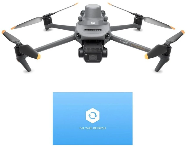
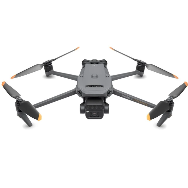

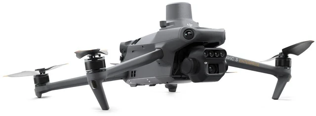
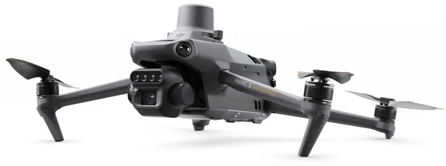


DJI Mavic 3M Multispectral Drone with RC Controller, Bundle with Care Enterprise Basic 1-Year Plan
- EXTENDED FLIGHT TIME - Enjoy up to 43 minutes of flight time, allowing for extensive data collection and reduced downtime in the field for comprehensive aerial surveys and inspections.
- SUPERIOR CAMERA QUALITY - Capture high-resolution imagery with a 20MP RGB camera and dedicated multispectral sensors, ensuring detailed and accurate data for precision agriculture analysis.
- EXPANDED OPERATIONAL RANGE - Achieve reliable connectivity up to 15 km in optimal conditions, facilitated by the DJI O3 Image Transmission, enabling wide-area mapping and remote monitoring.
- PRECISION GPS TECHNOLOGY - Benefit from enhanced positioning accuracy with integrated RTK module, ensuring centimeter-level precision for reliable data collection and accurate georeferencing.
+
+
Overview
Specs
Reviews

Any questions? Our AI mode will help you find out quickly.
Try me now
Effective aerial surveying needs to see the invisible. That's why Mavic 3 Multispectral has two forms of sight. It combines an RGB camera with a multispectral camera to scan and analyze crop growth with total clarity. Agricultural production management requires precision and data, and Mavic 3M delivers both. Multispectral + RGB imaging systemHighly integrated imaging systemNewly upgraded imaging system with one 20MP RGB camera and four 5MP multispectral cameras (green, red, red edge, and near infrared). Enables applications such as high-precision aerial surveying, crop growth monitoring, and natural resource surveys.
5 MP Multispectral
Camera Near-infrared (NIR): 860 nm +/- 26 nm
Red edge (RE): 730 nm +/- 16 nm
Red (R): 650 nm +/- 16 nm
Green (G): 560 nm +/- 16 nmRGB camera characteristics 4/3 CMOS 20MP image sensor 1/2000s Fastest mechanical shutter speed 0.7 s High-speed burst when RGB camera is usedSunlight SensorThe built-in sunlight sensor captures solar irradiance and records it in an image file, allowing for light compensation of image data during 2D reconstruction. This results in more accurate NDVI results, as well as improved accuracy and consistency of data acquired over time. RTK module - Accurate images that capture every pixelMavic 3M with RTK module for centimeter-level positioning. Flight control, the camera, and the RTK module sync in microseconds to accurately capture the location of each camera's imaging center. This enables Mavic 3M to do high-precision aerial surveying without using ground control points. Efficient and reliable battery life Ultra-long battery life, fast bursts 43 minutes Cruise time 200 hectare a single flight can complete mapping operations over an area of 200 hectares Fast charging 100W Battery Charging Hub High-efficiency fast charging 88W fast charging AircraftStable signal, smooth image transmissionThe O3 transmission integrates two transmitting signals and four receiving signals to support 15km ultra-long transmission distances. Omnidirectional obstacle sensing, terrain-follow aerial surveyingThe aircraft features multiple wide-FOV vision sensors that accurately detect obstacles in all directions for omnidirectional obstacle avoidance.
The terrain-follow aerial surveying can be easily performed in steep-slope landscapes. ApplicationsOrchard mappingMavic 3M allows terrain-follow aerial surveying of orchards, even on sloped landscapes. Together with DJI Terra or DJI SmartFarm Platform to reconstruct high-resolution orchard maps, automatically identify the number of trees, distinguish trees from other obstacles or objects, and generate three-dimensional operation routes for agricultural drones, making operations safer and more efficient. Mavic 3M aerial surveying DJI Terra / DJI SmartFarm Platform Mapping Generate 3D Routes Agricultural Drone OperationGuide variable rate applicationsFor rice fertilization, cotton growth regulation, and potato foliar fertilizer spraying, the Mavic 3M is used to obtain multi-spectral images of crops. DJI Terra or the DJI SmartFarm Platform can then generate NDVI and other vegetation indices maps, capturing differences in crop potential and generating prescription maps that allow agricultural drones to execute variable-rate application. This ultimately allows users to reduce costs, increase yield, and protect the environment. Mavic 3M aerial surveying DJI SmartFarm Platform Generates prescription maps for cropland Agricultural DroneIntelligent field scoutingThe Mavic 3M can carry out automatic field scouting. The field scout images can be uploaded to the DJI SmartFarm Platform in real time through a 4G network.
It can find abnormalities, such as emergence deficiencies, weed pressure, and crop lodging in a timely manner
5 MP Multispectral
Camera Near-infrared (NIR): 860 nm +/- 26 nm
Red edge (RE): 730 nm +/- 16 nm
Red (R): 650 nm +/- 16 nm
Green (G): 560 nm +/- 16 nmRGB camera characteristics 4/3 CMOS 20MP image sensor 1/2000s Fastest mechanical shutter speed 0.7 s High-speed burst when RGB camera is usedSunlight SensorThe built-in sunlight sensor captures solar irradiance and records it in an image file, allowing for light compensation of image data during 2D reconstruction. This results in more accurate NDVI results, as well as improved accuracy and consistency of data acquired over time. RTK module - Accurate images that capture every pixelMavic 3M with RTK module for centimeter-level positioning. Flight control, the camera, and the RTK module sync in microseconds to accurately capture the location of each camera's imaging center. This enables Mavic 3M to do high-precision aerial surveying without using ground control points. Efficient and reliable battery life Ultra-long battery life, fast bursts 43 minutes Cruise time 200 hectare a single flight can complete mapping operations over an area of 200 hectares Fast charging 100W Battery Charging Hub High-efficiency fast charging 88W fast charging AircraftStable signal, smooth image transmissionThe O3 transmission integrates two transmitting signals and four receiving signals to support 15km ultra-long transmission distances. Omnidirectional obstacle sensing, terrain-follow aerial surveyingThe aircraft features multiple wide-FOV vision sensors that accurately detect obstacles in all directions for omnidirectional obstacle avoidance.
The terrain-follow aerial surveying can be easily performed in steep-slope landscapes. ApplicationsOrchard mappingMavic 3M allows terrain-follow aerial surveying of orchards, even on sloped landscapes. Together with DJI Terra or DJI SmartFarm Platform to reconstruct high-resolution orchard maps, automatically identify the number of trees, distinguish trees from other obstacles or objects, and generate three-dimensional operation routes for agricultural drones, making operations safer and more efficient. Mavic 3M aerial surveying DJI Terra / DJI SmartFarm Platform Mapping Generate 3D Routes Agricultural Drone OperationGuide variable rate applicationsFor rice fertilization, cotton growth regulation, and potato foliar fertilizer spraying, the Mavic 3M is used to obtain multi-spectral images of crops. DJI Terra or the DJI SmartFarm Platform can then generate NDVI and other vegetation indices maps, capturing differences in crop potential and generating prescription maps that allow agricultural drones to execute variable-rate application. This ultimately allows users to reduce costs, increase yield, and protect the environment. Mavic 3M aerial surveying DJI SmartFarm Platform Generates prescription maps for cropland Agricultural DroneIntelligent field scoutingThe Mavic 3M can carry out automatic field scouting. The field scout images can be uploaded to the DJI SmartFarm Platform in real time through a 4G network.
It can find abnormalities, such as emergence deficiencies, weed pressure, and crop lodging in a timely manner
Warranty & Returns
Warranty, Returns, And Additional Information
Warranty
- Please contact the Seller directly for warranty information. Warranty information may also be found on the Manufacturer's website.
- Read full details
- CONTACT
Return Policies
- Return for refund within: 30 days
- Return for replacement within: non-replaceable
- This item is covered by Adorama Return Policy
Manufacturer Contact Info
- For a directory of all our manufacturers, please click below.
- Manufacturers Directory
LOADING...