Your Browsing History
- Free 30-day Returns
$151.16

Meet Your Seller
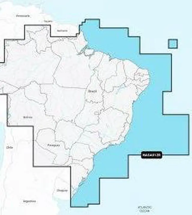
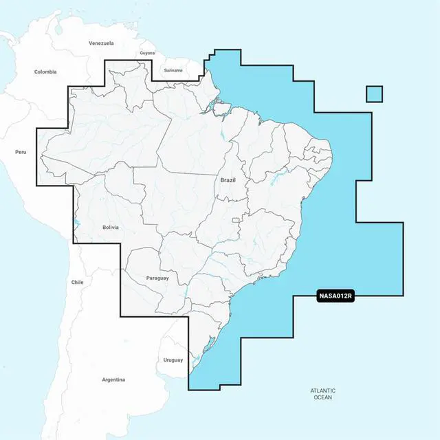


NAVIONICS NASA012R BRAZIL
- pNasa012R - Brazil - Navionics+ Get The World&Rsquo;S No. 1 Choice In Marine Mapping - With The Best, Most Up-To-Date Navionics+ Cartography On A Compatible Chartplotter. For Offshore Or Inland Waters, This All-In-One Solution Offers Detail-Rich Integrated Mapping Of Coastal Waters, Lakes, Rivers, And More. Get Sonarchart 1&Rsquo; (0.5 Meters) Hd Bathymetry Maps And Advanced Features Such As Dock-To-Dock Route Guidance Technology, Live Mapping, And Plotter Sync To Provide Wireless Access To Daily Updates. The Navionics Chart Installer Software Also Ensures The Freshest Chart Data Every Time. Navionics Dock-To-Dock Route Guidance Solutions Suggest A Path To Follow Through Channels, Inlets, Marina Entrances, And More. Multiple Shading Options Aid In Shallow-Water Navigation And Make It Easy To Highlight A Target Depth Range For The Best Fishing Spots. Chart Code: Nasa012R Coverage Area: Detailed Coverage Of The Coast Of Brazil. Also Including The Amazon River From Benjamin Constant To Th
+
+
Overview
Reviews
Any questions? Our AI beta will help you find out quickly.
Try me now
liNasa012R - Brazil - Navionics+ Get The World&Rsquo; S Nolili 1 Choice In Marine Mapping - With The Best, Most Up-To-Date Navionics+ Cartography On A Compatible Chartplotterlili For Offshore Or Inland Waters, This All-In-One Solution Offers Detail-Rich Integrated Mapping Of Coastal Waters, Lakes, Rivers, And Morelili Get Sonarchart 1&Rsquo; (0lili5 Meters) Hd Bathymetry Maps And Advanced Features Such As Dock-To-Dock Route Guidance Technology, Live Mapping, And Plotter Sync To Provide Wireless Access To Daily Updateslili The Navionics Chart Installer Software Also Ensures The Freshest Chart Data Every Timelili Navionics Dock-To-Dock Route Guidance Solutions Suggest A Path To Follow Through Channels, Inlets, Marina Entrances, And Morelili Multiple Shading Options Aid In Shallow-Water Navigation And Make It Easy To Highlight A Target Depth Range For The Best Fishing Spotslili Chart Code: Nasa012R
Coverage Area: Detailed Coverage Of The Coast Of Brazillili Also Including The Amazon River
Coverage Area: Detailed Coverage Of The Coast Of Brazillili Also Including The Amazon River
Warranty & Returns
Warranty, Returns, And Additional Information
Warranty
- Please contact the Seller directly for warranty information. Warranty information may also be found on the Manufacturer's website.
- CONTACT
Return Policies
- Return for refund within: 30 days
- Return for replacement within: 60 days
- This item is covered by VirVentures Return Policy
Manufacturer Contact Info
- For a directory of all our manufacturers, please click below.
- Manufacturers Directory
LOADING...